


Bagyong Goring patuloy na lumalakas, itinaas ang Signal no. 1 sa bahagi ng Luzon –PAGASA
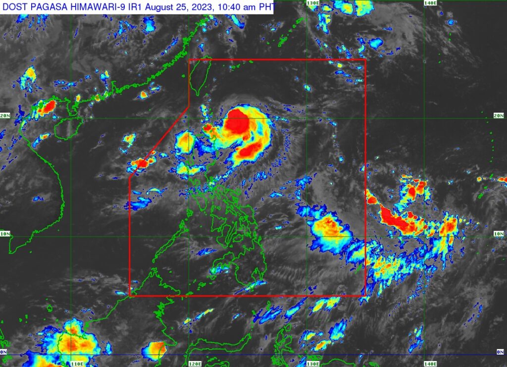
PHOTO: Facebook/Dost_pagasa
PATULOY na lumalakas ang Bagyong Goring habang binabadya ang timog bahagi ng bansa, ayon sa latest report ng Philippine Atmospheric, Geophysical and Astronomical Services Administration (PAGASA).
As of this writing, itinaas na ang Tropical Cyclone Wind Signal No. 1 sa ilang lugar sa Luzon.
Sakop nito ang mga sumusunod:
- Batanes
- Eastern portion of Babuyan Islands (Babuyan Island, Camiguin Island)
- Eastern portion of mainland Cagayan (Santa Ana, Gonzaga, Lal-Lo, Gattaran, Baggao, Peñablanca, Santa Teresita, Buguey, Camalaniugan, Aparri)
- Eastern portion of Isabela (Maconacon, Divilacan, Palanan, Dinapigue, San Mariano, San Pablo, Cabagan, Tumauini, Ilagan City)
Asahan sa mga nabanggit na lugar ang mahina hanggang sa malakas na pag-ulan.
Baka Bet Mo: Bagyong Goring posibleng maging ‘typhoon’ sa darating na weekend – PAGASA
Base sa weather report ngayong 11 a.m., August 25, huling namataan ang bagyo sa layong 225 kilometers East Southeast ng Basco, Batanes o 270 kilometers silangan ng Calayan, Cagayan.
Taglay nito ang lakas na hanging 85 kilometers per hour malapit sa gitna at bugsong aabot sa 105 kilometers per hour.
Kasalukuyang mabagal ang pagkilos ng bagyo na papunta sa timog.
“GORING is forecast to move south southwestward or southward over the waters east of Northern Luzon until tomorrow evening, then turn generally south or southeastward for the rest of tomorrow through Sunday afternoon,” saad sa bulletin report ng PAGASA.
Dagdag pa, “For the most of the forecast period, GORING is forecast to move slowly.”
Nagbabala rin ang weather bureau na inaasahang magiging isang ganap na “typhoon” ang Bagyong Goring simula Sabado, August 26.
“Due to highly favorable environment, GORING is forecast to rapidly intensify and may reach typhoon category by tomorrow,” abiso ng ahensya.
Ani pa, “It may reach its peak intensity on Sunday evening, after which it is forecast to maintain strength until the end of the forecast period. The potential for developing into a super typhoon is not ruled out.”
Para sa araw na ito, magdadala ng kalat-kalat na pag-ulan ang “trough” o buntot ng bagyo sa Cagayan Valley, Cordillera Administrative Region, at Ilocos Region.
Kaparehong weather conditions ang mararanasan sa Palawan, Occidental Mindoro, Zambales, at Bataan na dulot naman ng Southwest Monsoon o Hanging Habagat.
Dahil sa nasabing weather system, uulanin din ang Metro Manila at nalalabing bahagi ng bansa.
Read more:
El Niño idineklara na sa bansa, magtatagal hanggang 2024 –PAGASA
Disclaimer: The comments uploaded on this site do not necessarily represent or reflect the views of management and owner of Bandera. We reserve the right to exclude comments that we deem to be inconsistent with our editorial standards.