


Bagyong Enteng tumama sa Quirino Province, Signal No. 2 nabawasan
MATAPOS mag-landfall o tumama sa bahagi ng Aurora, hinahagupit naman ng Bagyong Enteng ang Quirino province.
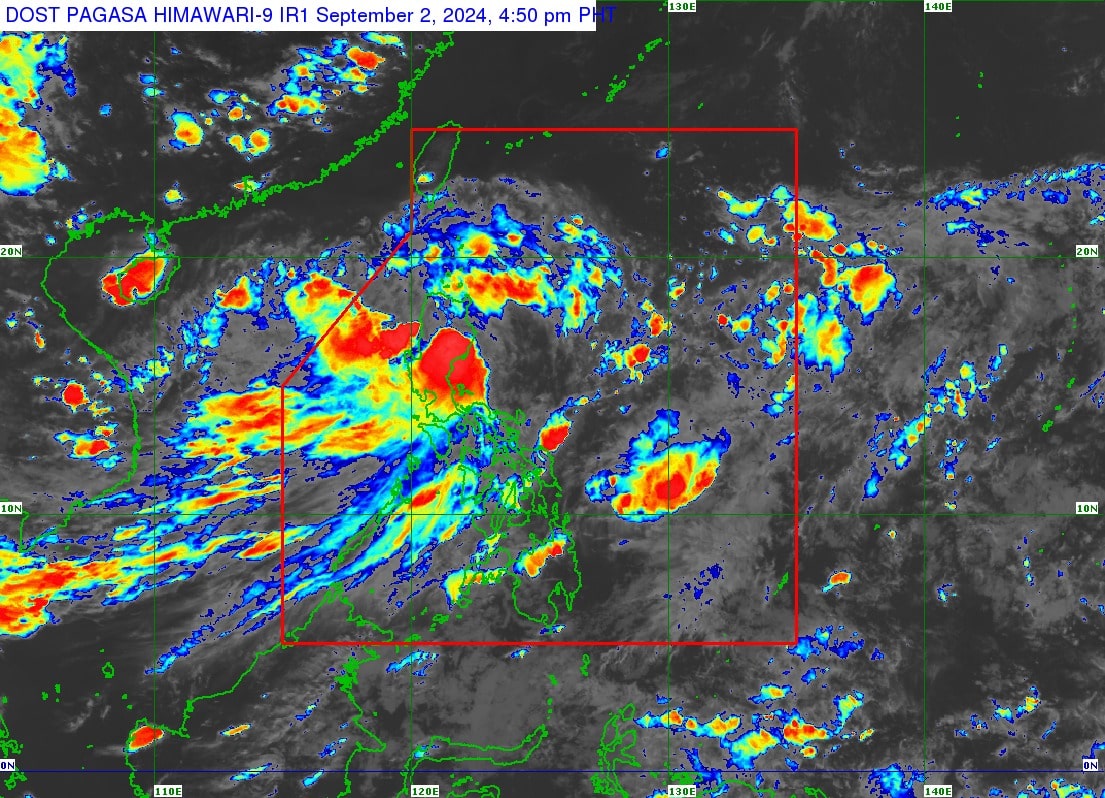
Ito ay ayon sa 5 p.m. weather bulletin ng Philippine Atmospheric, Geophysical and Astronomical Services Administration (PAGASA) ngayong araw, September 2.
Ang bagyo ay huling namataan sa bayan ng Maddela sa Quirino at kasalukuyan itong kumikilos pa-hilaga sa bilis na 20 kilometers per hour.
Nananatili ang taglay nitong hangin na 85 kilometers per hour malapit sa gitna at bugsong aabot sa 105 kilometers per hour.
Iniulat din ng weather bureau na nabawasan na ang mga lugar sa Luzon na isinailalim sa Tropical Cyclone Wind Signal No. 2.
Baka Bet Mo: PBBM: ‘Kung maaari bago tayo matulog, alam na kung may pasok bukas o wala’
Narito ang listahan: Ilocos Norte, Apayao, silangang bahagi ng Kalinga (Rizal, Pinukpuk, City of Tabuk), Cagayan kasama ang Babuyan Islands, Isabela, Quirino, at ang northern portion ng Aurora (Casiguran, Dilasag, Dinalungan, Dipaculao, Baler).
Habang ang Metro Manila ay nasa Signal No. 1 pa rin, kasama ang mga sumusunod na Luzon areas: Batanes, Ilocos Sur, La Union, silangang bahagi ng Pangasinan (Rosales, Asingan, Binalonan, Sison, San Manuel, Santa Maria, Balungao, San Quintin, Tayug, Umingan, Natividad, San Nicolas), Abra, ang nalalabing bahagi ng Kalinga, Mountain Province, Ifugao, Benguet, Nueva Vizcaya, ang natitirang lugar sa Aurora, Nueva Ecija, silangang bahagi ng Bulacan (Doña Remedios Trinidad, Norzagaray, City of San Jose del Monte, Obando, City of Meycauayan, Bocaue, Balagtas, Bustos, Baliuag, Pandi, Santa Maria, Marilao, Angat, San Rafael, San Ildefonso, San Miguel), Rizal, ang northeastern portion ng Laguna (Santa Maria, Mabitac, Pakil, Pangil, Famy, Siniloan), at ang northern portion ng Quezon (General Nakar, Infanta, Real) kasama ang isla ng Polillo.
Ayon sa forecast track ng PAGASA, inaasahang babadya ang Bagyong Enteng papunta sa Cagayan Valley o Cordillera Administrative Region (CAR), bago lumiko papunta sa Babuyan Channel bukas (September 3).
Pagdating naman daw ng Miyerkules, September 4, ito ay posibleng lumabas na ng Philippine Area of Responsibility.
“ENTENG is forecast to maintain tropical storm category during its traverse of mainland Northern Luzon. Further intensification is forecast to occur from tomorrow (Sept. 3) afternoon onwards, with ENTENG becoming a severe tropical storm by tomorrow afternoon or evening (at the earliest), and typhoon category by Thursday (Sept. 5),” saad sa latest report ng ahensya.
Disclaimer: The comments uploaded on this site do not necessarily represent or reflect the views of management and owner of Bandera. We reserve the right to exclude comments that we deem to be inconsistent with our editorial standards.